Explore more
About
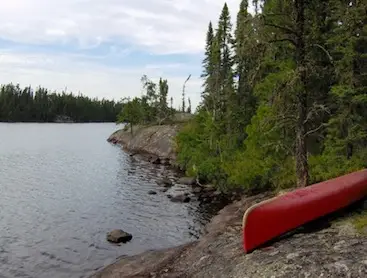
Wabakimimaps. Com is the go-to mapping service for superior back-country canoeing in Callander. This online platform provides detailed and easy-to-use maps for the Albany River, Brightsand River, and Kopka River canoe routes within Wabakimi Provincial Park. Each map set covers a complete route, showcasing rapids, swifts, waterfalls, portages, and campsites.
The maps are continually updated to ensure accuracy and provide additional route choices, alternative starts and finishes, and detailed views of portage locations and lengths. The large scale of the maps allows paddlers to easily read and follow their progress while on the water. Each 8 1/2 × 11 page is laminated, back to back, to stay dry and organized with a plastic tie to prevent loss and make flipping between sections of the route seamless.
Wabakimimaps. Com has partnered with Friends of Wabakimi to support the protection and conservation of this pristine wilderness canoeing region. Users can also purchase downloadable PDF versions of the map sets from the Friends of Wabakimi store. Customer testimonials rave about the quality and level of detail provided on the maps, making trip planning and navigation a breeze.
Whether you are a seasoned paddler or planning your first back-country canoeing adventure, Wabakimimaps. Com is the resource you need to explore the untouched beauty of Wabakimi Provincial Park. Don't miss out on the opportunity to access these invaluable maps and enhance your outdoor experience.